


Victoria has signed off on Ballarat’s next big growth front. The detail builders will price against is not public yet, and the draft it replaces tells a slightly different story.
Ballarat has its next suburb.
The City of Ballarat has announced that the state government has approved the Ballarat North Precinct Structure Plan, the blueprint for new housing on farmland around Mount Rowan, north of the Western Freeway. Formal gazettal is expected within days.
For builders working the Ballarat market, it is the largest planned addition to the city’s land supply in years. But approval is a starting gun, not a finish line. Here is what is on the public record, what has changed, and what is still unknown.
Ballarat North is one of Victoria’s 21 priority housing projects
The precinct sits about 8 kilometres north of the Ballarat CBD, bounded by Cummins Road to the north and the Midland Highway to the east. The Minister for Planning appointed the Victorian Planning Authority to lead the plan on 31 August 2022, at the council’s request.
It is one of 21 priority projects named in Victoria’s Housing Statement, which together are expected to contribute 60,000 homes.
The draft went on public exhibition from 19 September to 20 October 2025. Unresolved issues went to a Standing Advisory Committee, which held hearings from 23 March to 27 April 2026, with its report due on 5 June.
Under Plan for Victoria, the City of Ballarat has a target of 46,900 new homes by 2051, with 18,900 of those in greenfield areas. The exhibited explanatory report says this one precinct would deliver about 30 per cent of that greenfield share.
The approved figures differ from the exhibited draft
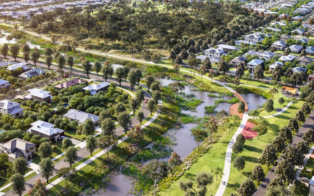
According to the council, the approved plan provides for almost 6,000 homes and around 13,000 residents, with four schools, a neighbourhood centre, two sports reserves and 7.5 hectares of parkland. It puts the infrastructure investment at an estimated $164 million.
The exhibited draft from September 2025 planned for 5,523 dwellings and a population of 15,467, based on 2.8 people per home. Its development contributions plan costed shared infrastructure at $184.2 million.
On those numbers, the approved plan has close to 500 more homes, about 2,500 fewer residents and roughly $20 million less in infrastructure than the draft.
The final documents had not been published at the time of writing. The state entered caretaker mode at 6pm on 3 November ahead of the 28 November election, and the planning authority’s project page still shows the exhibited versions.
Until the gazetted documents are public, it is not possible to say whether the $164 million compares like for like with the draft figure, or what drove the lower population estimate.
A suburb planned around smaller lots and more housing types
The exhibited draft set a minimum average of 20 dwellings per net developable hectare across the precinct.
It split the land into two housing catchments. Land within walking distance of activity centres, open space and the future bus network was set at an average of 25 dwellings per hectare or more. The balance of the precinct was set at 17 or more.
In the higher density catchment, planning applications were expected to enable at least three housing types, ranging from Small Lot Housing Code product and townhouses through to apartments and retirement living. The balance area needed at least two.
The draft also embedded a target of at least 13 per cent social or affordable housing, split 11 per cent social and 2 per cent subsidised market housing. How that is delivered is left to agreements between developers and the council at subdivision.
Bushfire controls are another fixed input. The exhibited amendment sets BAL 12.5 as the construction standard across the precinct and states that future dwellings will not exceed it.
What is a precinct structure plan?
A precinct structure plan (PSP) is the Victorian planning document that sets out where housing, schools, shops, parks, roads and drainage will go in a new suburb. It sits alongside a development contributions plan (DCP), which costs the shared infrastructure and sets the levies developers pay towards it, usually charged per net developable hectare. Once both are in the planning scheme, the council assesses subdivision permits against them.
Infrastructure levies are set per hectare, long before a slab is poured
The development contributions plan is where the money sits.
In the exhibited version, developers would pay a development infrastructure levy of $672,901 per net developable hectare. That covers roads, intersections, a creek crossing, drainage and community facilities. A separate community infrastructure levy was set at $599.34 per dwelling.
At the minimum average of 20 homes per hectare, the development levy works out at roughly $33,600 per dwelling. At 17 per hectare it is closer to $39,600. These are our calculations from the exhibited figures, and the approved rate may differ.
Developers pay these levies, but they flow into the price of a lot. For builders quoting house and land packages, the final rate feeds directly into how much of a buyer’s budget is left for the build.
Approval is the start of the pipeline. It is not the pipeline.
The council’s own submission on the draft treated this as unfinished business. It made nearly 80 recommendations, including concerns about gaps in costing and apportionment, road upgrades it wanted added to the levy, and missing pedestrian crossings.
The approved suburb is the core of a larger northern growth area
The council describes the northern growth area as 832 hectares in total. The approved plan covers the core of it, roughly 570 hectares south of Cummins Road.
North of Cummins Road sits an expanded area of about 270 hectares that stays in the farming zone for now. The council has said planning will begin on that land, which it expects to hold a further 2,600 homes.
In its submission, the council argued the expanded area should have been included from the start, to share infrastructure costs fairly and give the market long term certainty.
First lots are still some way off
The council has previously said it expected development could start from 2027, once the plan is in place and developers lodge planning permit applications.
From there, the familiar sequence applies. Permits, civil works, titles, then slab starts. Each stage depends on drainage, roads and services arriving in order, and the draft relies on five new wetlands and an upgraded Burrumbeet Creek crossing at Cummins Road to make that work.
For builders, the open question is not whether Ballarat North happens. It is when the first titles land, at what lot sizes, and at what land price once the levies are built in.
THE GOOD BUILDER TAKE
The headline numbers will get the attention. The levy rate and the staging plan deserve more of it.
In growth areas, the cost of servicing land is locked in well before a builder signs a contract, and it shapes the build budget buyers have left. Ballarat North’s final figures will show how much room that leaves.
Approval is the start of the pipeline, not the pipeline itself
Ballarat North gives the region something it has needed for a while: a planned growth front with a defined housing mix and a costed infrastructure list.
But approval is the start of the pipeline. It is not the pipeline. The numbers builders will actually work with, the final levy, the staging and the first land releases, are still to come.
We will report on the gazetted documents once they are public. If you build or trade in the Ballarat region and want to share what you are seeing on the ground, get in touch with our team.
Frequently Asked Questions
It is about 8 kilometres north of the Ballarat CBD, north of the Western Freeway and around Mount Rowan. The approved core is bounded by Cummins Road to the north and the Midland Highway to the east, with Miners Rest nearby.
The City of Ballarat says the approved plan provides for almost 6,000 homes and around 13,000 residents. The exhibited draft from September 2025 planned for 5,523 dwellings. The council expects a further 2,600 homes north of Cummins Road, which is yet to be planned.
The council has previously said development could start from 2027, after the plan is gazetted and developers obtain planning permits for subdivision. Lot releases depend on roads, drainage and services being delivered in sequence.
The exhibited development contributions plan set a development infrastructure levy of $672,901 per net developable hectare and a community infrastructure levy of $599.34 per dwelling. The approved rates had not been published at the time of writing.
Last updated: 5 November 2026. Figures are from the exhibited September 2025 documents unless attributed to the City of Ballarat, and will be updated once the gazetted plan is published.
General Information Only: This article is general information only and does not constitute legal, financial or professional advice. It does not take into account your particular circumstances. You should obtain independent professional advice before making any decision based on this information. While we take care to ensure accuracy at the time of publication, planning controls, levies and figures can change.



0 Comments